search
Physical map of Belgium
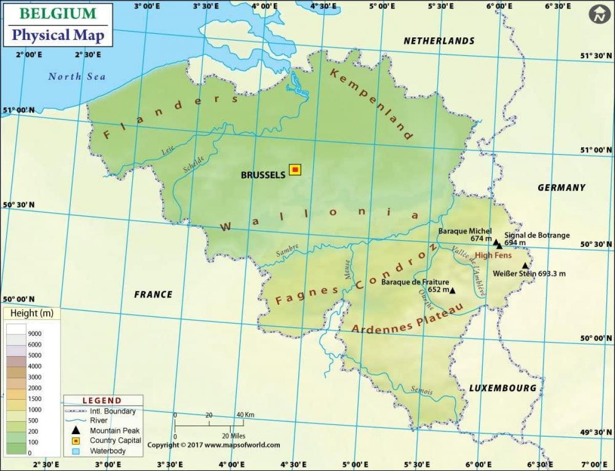
Belgium topographic map. Physical map of Belgium (Western Europe - Europe) to print. Physical map of Belgium (Western Europe - Europe) to download. Belgium has three main geographical regions: the coastal plain in the north-west, the central plateau, and the Ardennes uplands in the south-east. The coastal plain consists mainly of sand dunes and polders. Polders are areas of land, close to or below sea level that have been reclaimed from the sea, from which they are protected by dikes or, further inland, by fields that have been drained with canals as its shown in the physical map of Belgium. The second geographical region, the central plateau, lies further inland. This is a smooth, slowly rising area that has many fertile valleys and is irrigated by many waterways. Here one can also find rougher land, including caves and small gorges.
The third geographical region, called the Ardennes, is more rugged than the first two. It is a thickly forested plateau, very rocky and not very good for farming, which extends into northern France and in Germany where it is named Eifel as its mentioned in the physical map of Belgium. This is where much of Belgium wildlife can be found. Belgium has relatively few natural lakes, and none of any great size. Notable natural regions include the Ardennes, Campine and High Fens.


