search
Belgium climate map
Map of Belgium climate. Belgium climate map (Western Europe - Europe) to print. Belgium climate map (Western Europe - Europe) to download. Belgium has a temperate, maritime climate predominantly influenced by air masses from the Atlantic. Rapid and frequent alternation of different air masses separated by fronts gives Belgium considerable variability in weather. Frontal conditions moving from the west produce heavy and frequent rainfall, averaging 30 to 40 inches (750 to 1,000 mm) a year. Winters are damp and cool with frequent fogs; summers are rather mild as its shown in Belgium climate map. The annual mean temperature is around 50 °F (10 °C). Brussels, which is roughly in the middle of the country, has a mean minimum temperature of just below 32 °F (0 °C) in January and a mean maximum of about 71 °F (22 °C) in July.
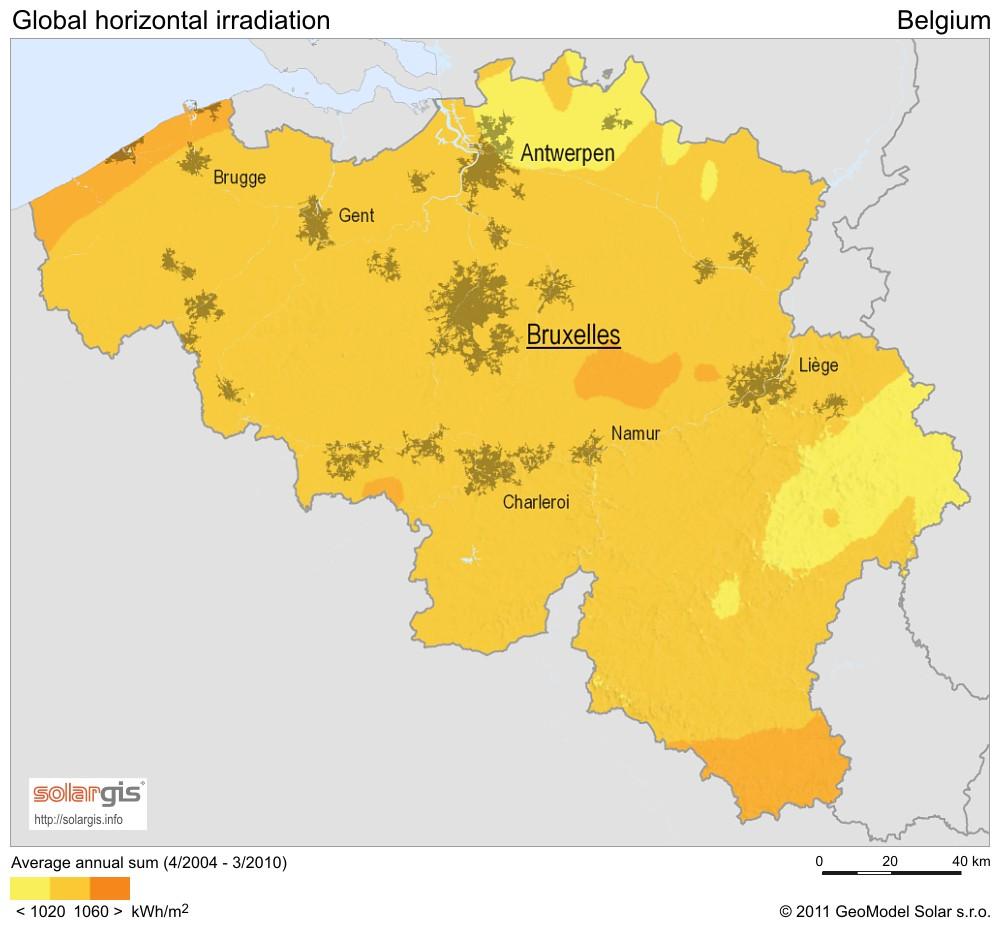
Regional climatic in Belgium differences are determined by elevation and distance inland. Farther inland, maritime influences become weaker, and the climate becomes more continental, characterized by greater seasonal extremes of temperature. The Ardennes region, the highest and farthest inland, is the coldest. In winter, frost occurs on about 120 days, snow falls on 30 to 35 days, and January mean minimum temperatures are lower than elsewhere. In summer, the elevation counteracts the effect of distance inland, and July mean maximum temperatures are the lowest in the country. Because of the topography, the region has the highest rainfall in Belgium as its mentioned in Belgium climate map.