search
Belgium elevation map
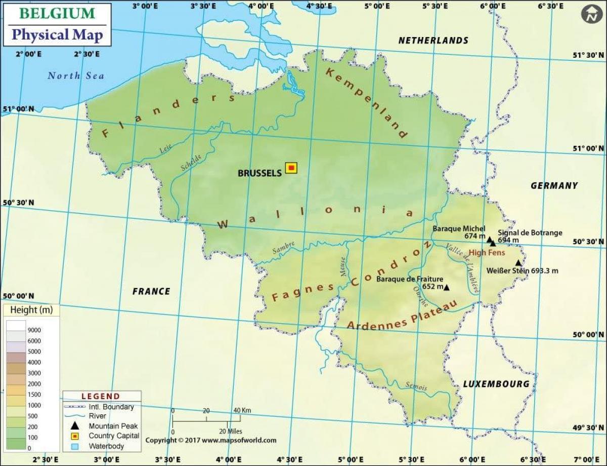
Map of Belgium elevation. Belgium elevation map (Western Europe - Europe) to print. Belgium elevation map (Western Europe - Europe) to download. Belgium highest elevation point is the Signal de Botrange at 694 metres above the sea level, it is located in the High Fens (Hautes Fagnes in French, Hoge Venen in Dutch) as its shown in Belgium elevation map. It is the top of a broad plateau, and a road crosses the summit, passing an adjacent café. Other hills in Belgium include the Kemmelberg (159 m high) and the Koppenberg (77 m high) both known as being climbed by professional cyclist during the annual cycling road races of respectively Gent–Wevelgem and the Tour of Flanders.
The extreme elevation points in Belgium are as follow: Northernmost point — Dreef, municipality of Hoogstraten, Antwerp, Southernmost point — Torgny, municipality of Rouvroy, Luxembourg; Westernmost point — De Panne, West Flanders; Easternmost point — Krewinkel, municipality of Büllingen, Liège
Highest point — Signal de Botrange (694 m), Lowest point — De Moeren (-3 m) as its mentioned in Belgium elevation map. The Belgian National Geographic Institute calculated that the central point of Belgium lies at coordinates 50°38′28″N 4°40′05″E / 50.64111°N 4.66806°E, in Nil-Saint-Vincent-Saint-Martin in the municipality of Walhain.


