search
Belgium geography map
Map of Belgium geography. Belgium geography map (Western Europe - Europe) to print. Belgium geography map (Western Europe - Europe) to download. Belgium generally is a low-lying country, with a broad coastal plain extending in a southeasterly direction from the North Sea and the Netherlands and rising gradually into the Ardennes hills and forests of the southeast as its shown in Belgium geography map. The main physical regions are the Ardennes and the Ardennes foothills; Côtes Lorraines (Belgian Lorraine), the intrusion of the Paris Basin in the south; and the Anglo-Belgian Basin in the north, comprising the Central Plateaus, the plain of Flanders, and the Kempenland (French: Campine).
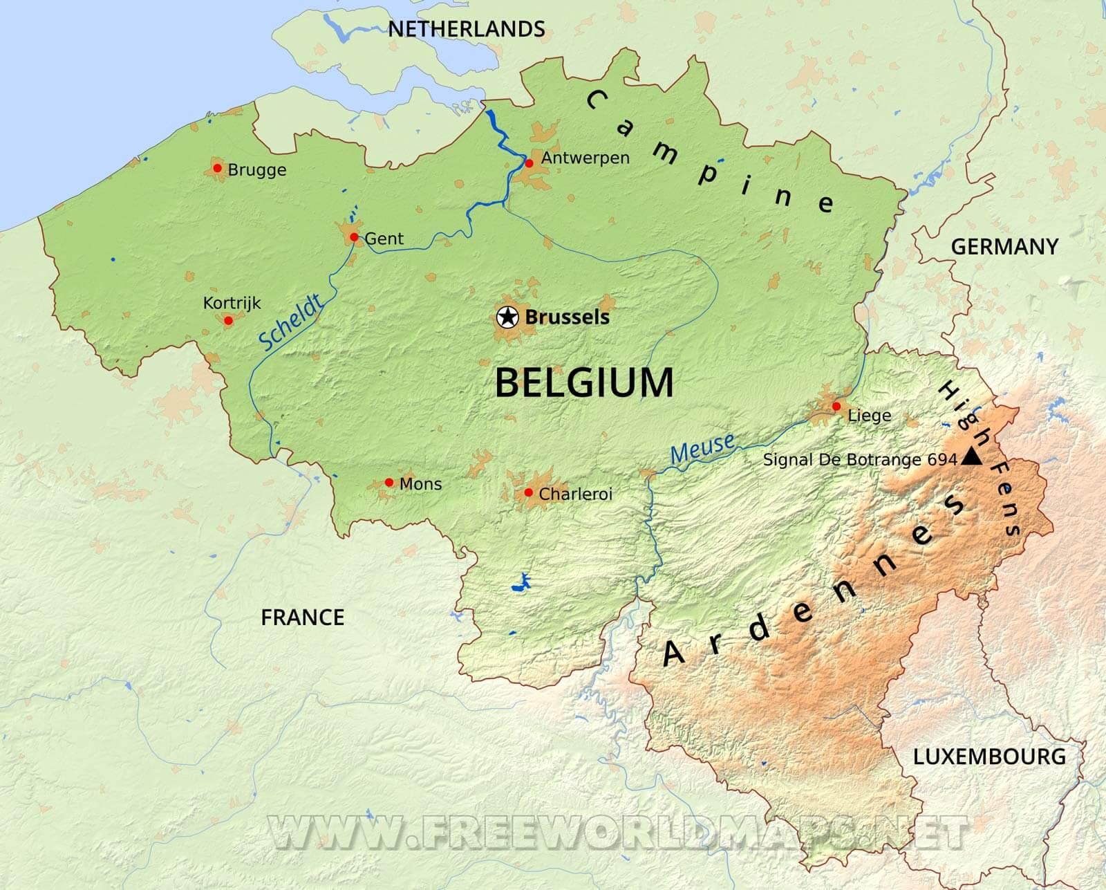
One of the smallest countries in Europe, Belgium is bordered by France, Luxembourgh, the Netherlands, and Germany. The country also has a narrow coastline along the North Sea. Belgium primarily lies close to sea level, though the country does reach 2,277 feet (694 metres) at a point known as Botrange, which lies within the Ardennes plateau.